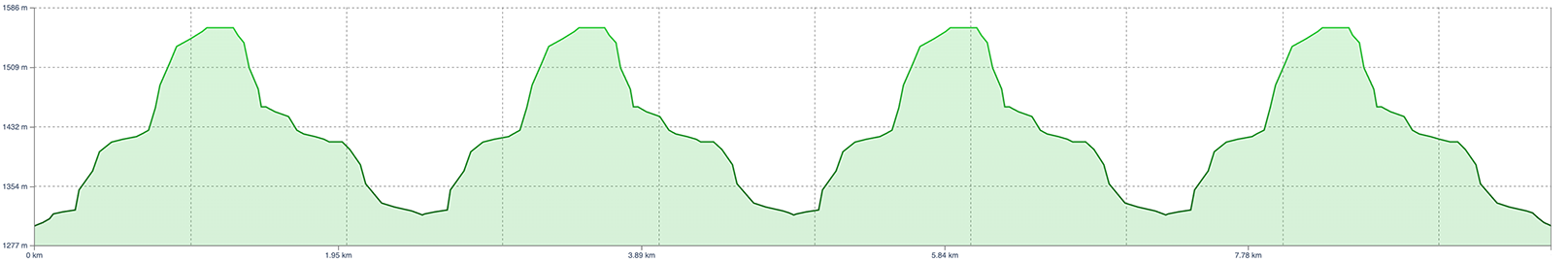
Distance: 9.75km
Gain/Loss: 1,000m (25% average grade on the climb)
Max Elevation: 1583m
Trail Type: Double track, single track
Duration: 3 hours
GPX File: Vertical Vendetta Full Route
Check out the original Google Map, or the new RunGo map that includes the elevation profile:
(image side scrolls for smaller screens)


Sinister Sports Inc.
Box 460 Bellevue, AB, T0K 0C0
E:


Get your
Sinister Sports X MarsQuest
sunglasses here!
©2020-2025 Sinister Sports Inc. All Rights Reserved.